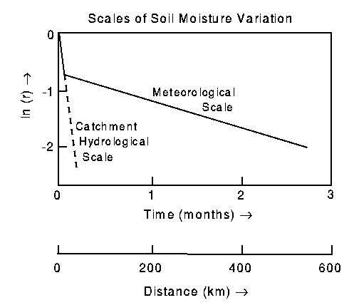
Figure 1. Schematic diagram of hydrological and meteorological
scales of soil moisture variations. r is the autocorrelation
function. The scales are determined by the slopes of the curves:
for time scales,  , t is time and
T is the time scale; for spatial scales,
, t is time and
T is the time scale; for spatial scales,  ,
d is distance and L is the length scale.
,
d is distance and L is the length scale.